“Avoid 6 deadly drone mapping mistakes! Optimize your projects with expert tips for precision and success. Elevate your drone mapping game today!”
Drones have changed the mapping industry by giving remarkable depth and precision. Many businesses or people are interested in the drone mapping business but mastering drone mapping needs a stronger knowledge and careful consideration of the danger that it poses.
You must not only be knowledgeable about the drone mapping process but also about the geographic, environmental, physical, and surrounding factors that can affect your data and drone mapping process.
You must also be an excellent drone pilot who understands how to fly, where to fly, and plan for a mapping operation.
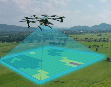
Drone Mapping
Drone mapping (also known as drone surveying) can be defined as a simple approach to collecting data with drones.
As the name implies, it means mapping a certain region with the help of drones and providing different useful data and analytics to the clients which may include orthomisaic, digital models, and 3D models of the surveyed map.
Drone mapping can help in the collection of data in a more detailed manner than the traditional method like ground surveys.
Drone mapping works by scanning a large area with the drone and using mapping points to map the interested region. Then these photos are combined with the help of different software to get the full image known as orthomosaic.
Many software are available that can detect 3D features in various areas. Drone mapping outputs can be used to make a digital rendering of the physical space for understanding and examination.
6 Deadly Drone Mapping Mistakes
At Upload Media, we have dealt with numerous clients who have engaged in less expensive drone mapping mistakes surveying services without experience, only to wind up with untrustworthy data and costly blunders.
In many situations, customers pay twice as they are met with many problems in drone mapping. This drone mapping mistake can cost a huge deal when not looked after as many things are influenced by the mapping of an area and can cause more harm than good.
Here are some of the deathly mistakes in drone mapping that can cost you a fortune:
Neglecting Flight Planning
Drones are used in area mapping as they follow a predestined path insured for them but inadequate flight can lead to huge problems in drone mapping.
Inadequate Flight planning is one of the most common mistakes in drone mapping made by people.
You should plan your flight by using mapping software and taking into account many factors like topography, impediments, and degrees are many things that would affect your flight.
We at Upload Media recommend before every flight you should do comprehensive pre-flight monitoring to ensure every component of your drone is working or not.
This involves inspecting the batteries, motors, propellers, and camera settings of the drone.
Not paying attention to this step causes a technical problem during your fight and can result in an error in your data and readings or even device failure.
An incorrect height, speed, or overlap can cause major damage to your drone or the data that you have collected.
Other factors like weather, wind, or lighting conditions have major distortions in your data or image
Failure to monitor your drone’s settings, calibration, and firmware may also result in malfunctions or accidents during flight.
To avoid these mistakes, you must do an appropriate check and perform the mapping to ensure a great and effective mapping for your clients.
Many Online tools and applications are now available that can help you in planning and optimizing your drone settings. Finally, before every flight, you must inspect your drone, condition, and software update.
Overlooking Environmental Factors
Drone mapping accuracy is significantly impacted by the surroundings such as lighting, rain, and wind can all affect how data is collected by the drone.
Before doing drone mapping, you should always check the weather of the place and stay clear of the indifferent weather inclination which can cause harm to your data.

The data performance can also be affected by different terrain factors, such as if you are flying in a challenging environment like in mountains, forests, and water. You have to be extra careful about the data that you are receiving.
Some other factors like elevation, barriers, reflections, and shadows are also some of the topographical factors that can affect your reading.
This factor can problem in data collection as data can change in different weather conditions and terrain, so need to be careful about where and how you are going to perform drone mapping.
To control these issues, you must be careful where you are mapping by the plan your flight plan and waypoints. By avoiding flying near the ground or objects you can use the sensor and avoid many problems of the terrain.
For example, you can use a map or simulator, gimbal, or any other stabilizer to prevent the camera from shaking during the rough terrain or distortion you expose to the contact points.
Power Management
Battery life is a limiting element in drone mapping operations. Neglecting basic battery management might result in missed flights and missing data sets.
Plan your mapping excursions with battery life in mind, and always have replacement batteries on hand.
Additionally, to ensure peak performance, monitor and replace batteries regularly.
The capacity of a battery is measured in milliampere-hours (mAh), which indicates how much charge it can hold.
A larger battery delivers more power, allowing the drone to stay aloft for longer periods and cover greater distances, expanding its range.
You should have extra batteries or a power backup to aid in successful mapping.
If the power goes off while mapping, the data may be distorted and the process must be restarted. So, to ensure a successful mapping experience for you and your client, you must have some backups.
Battery maintenance is, of course, crucial. Following the manufacturer’s charging and discharging recommendations is critical since incorrect charging/discharging can reduce capacity over time.
Inadequate Ground Control Points (GCPs)
Accurate georeferencing is essential for producing high-quality drone maps. Failure to create enough Ground Control Points might lead to spatial errors.
Furthermore, if you do not properly plan the GCPs, your maps will not turn out correctly. For example, you must ensure that they are placed around the perimeter of the survey site. Otherwise, because the map’s edges aren’t geotagged, they may shift.
After you install GCP, you must first record the GPS location that will help you to stay on the safe side and measure the GCP twice. This will ensure after the flight that you have shifted the project which would fix any problem.

Checking your coordinate system after every flight would help to increase the drone mapping software to make accurate drops and help in effective mapping.
In the long run, the precision of your GCPs is only as good as the accuracy of your GPS device. By using high-precision GPS you can record the position of the GCPs and double-check the data for effective accuracy.
By avoiding these factors, you can use your GCPs in optimal form to improve accuracy and get high-quality results from the mapping.
Inconsistent Lighting And Visuals
Lighting and visuals are also one of the most deadly mistakes made during drone mapping as you may not know it, but the location of the sun in the sky may have a significant impact on the quality of your drone mapping.
When the rays of the sun are directly over at midday, it will lower the chances of shadow distortion and provide you with a cleaner and more accurate photograph. On the other hand, when the sun is too bright the images will be too overexposed and can result in lower image quality.
Considering the light intensity and weather conditions around you, you must plan the mapping in the vicinity of every point. The brightness of the sun has a huge impact on your images and data.
Different weather conditions like cloudy days can also impact the quality of the sun’s rays on the land which can affect the quality of your photos.
Another drone mapping mistakes during the mapping is the direct sunshine and the camera sensitivity. Some cameras are more vulnerable to sun rays and hotspots as they will degrade the quilty of your image.
There are many tools like SunCalc which help to provide the sun’s location and help you to determine the size and direction of the harsh sunlight at different times of the day. This would be very helpful in desert areas to provide effective data collection.
By carefully evaluating these criteria, you can make your drone mapping effort effective and guarantee a high-quality image during the harsh daylight.
Always keep these factors in mind as you plan your drone mapping, striving for the optimal mix of light and shadow to produce the most accurate results.
Avoiding Utilizing Real-time Kinematic Positioning (RTK)
RTK stands for Real Time Kinematics. As a positioning and navigation system, RTK corrects GPS position data in real time as the drone flies over and surveys the selected area.
An RTK base provides GPS data straight to the drone, allowing you to keep the aircraft on course as it travels. Without RTK, 3D models may lack the precision required for building, agriculture, or infrastructure planning.
RTK allows the drone to fly within a 1-inch (3 cm) margin of error, improving the precision of your mapping data.
RTK, in essence, corrects for positional problems before they occur, requiring less correction in post-processing.
In many businesses that rely on accurate geospatial data, inaccurate mapping results in damage the decision-making and leads to many problems in the future.
If this is a cause then many companies would have a huge problem with drone mapping as their way of doing business.
Why Choose Upload Media Services For Aerial Mapping Surveys In Australia?
Upload Media Service is one of the leading providers of commercial drone mapping and surveys for your company. We are a CASA-certified and fully insured company that provides a wide range of services to different companies and people. We offer various useful services like Lidar Mapping, thermal mapping, and real estate photography to our clients.
- We are Certified and licensed by CASA Company
- We have Public Liability Insurance of $12 Million.
- Professional Liability Insurance of $6 Million
- Safety assessments for jobs
- Mine/Construction Spec Vehicles and Full PPE
- Drone fleet of the future
- GNSS ground control with PPK precision
How Can Upload Media Services Help You In Aerial Mapping Surveys In Australia?
Upload Media Services is a full-service content creation agency in Sydney. Our team of experienced marketers, photographers, and video producers use advanced software and techniques to help you reach your goals.
We create and provide customized, impactful services that resonate with your audience. Our teams take the time to understand your customers and ensure that their content speaks directly to them.
Professional & Tailored Service: We are a team of experienced drone operators with the necessary equipment and permits to complete your project
Advanced camera and UAV technology: Our commitment to providing high-quality service is made possible by our investment in advanced drone systems and camera equipment.
Protected up to $20M for public liability: Safety is paramount in all aspects of our operations. We are fully licensed and insured by CASA, which ensures that we have the necessary expertise and resources to operate safely and efficiently.
We are dedicated to helping you stand out from the competition and make your audience choose your brand over others.
FAQS On Aerial Media Mapping
Is Aerial Mapping The Same As Surveying?
No, Aerial mapping and surveying are related fields, but they are not the same. They both are used for the collection of spatial data for mapping and analysis, but they differ in their methods and purposes.
What Tools Are Used In Aerial Mapping?
Aerial mapping uses various tools and software to produce data-driven images and video of the place. Some of the tools are given below:
- Manned and unmanned vehicles, especially drones.
- Cameras for imagery.
- LiDAR for 3D mapping.
- GPS receivers for accurate georeferencing.
- Inertial Measurement Units (IMUs) for stability.
- Image processing for correction and analysis.
- GIS for data storage and visualization.
Why Is Aerial Mapping Important?
Aerial mapping is very important for many industries like construction, farming, real estate, and energy. They provide a more comprehensive and accurate view of the area being mapped compared to traditional ground-based mapping methods.
What Is The Purpose Of A Mapping Survey?
The purpose of the mapping surveys is to supply accurate measurements of the ground, including its topography and boundaries, other features that may impact the layout and construction of a task.
Why Are Aerial Mapping Done?
Drone mapping is done for views of cloud patterns obtained from orbiting satellites are valuable in weather forecasting. Aerial photography also has vital military reconnaissance and intelligence-gathering applications. They are mostly used to make 3D maps of the landscape to gather data.
Evden eve nakliyat hizmetinde kalite ve güven bir arada! Eşyalarım tam planlanan saatte taşındı ve tüm süreci sorunsuz tamamladılar. Hem hızlı hem de profesyonel bir ekip.
KARAKAR | Web sitenizi düzenli olarak güncellemek, güvenlik açıklarını kapatmak ve kullanıcı deneyimini geliştirmek için gereklidir. Güncellenmeyen siteler, zamanla işlevselliğini kaybeder.
KARAKAR | Web tasarım sadece bir görsellik meselesi değildir, aynı zamanda performans ve işlevsellikle de ilgilidir. Kullanıcı dostu arayüzler ve optimize edilmiş kod yapıları, web sitenizin başarısını artırır.
KARAKAR Web Tasarım ve Yazılım Ajansı | Kaliteli içerik ve SEO optimizasyonu, web sitenizin trafik kazanmasını sağlar.