Aerial Media || 3D & Photogrammetry || Aerial Mapping & Surveys || Thermal Imaging || Assets Inspection

Farm And Agriculture​

Affordable and Professional Aerial Data Solution, CASA Licensed and Certified Drone (RPA) Operators

Farm And Agriculture

Upload Enterprise is a leading provider of aerial drone solutions for the Farm and Agriculture sector. Our professional drones can determine water stress, low crop nutrients, and poor soil health which helps farmers to increase efficiency and profitability. 

Whether it’s Solar farm panel inspections, Solar farm aerial surveys, or Product photography for agricultural businesses our experienced professionals and advanced technologies help you make data-driven solutions to maximize your yields.

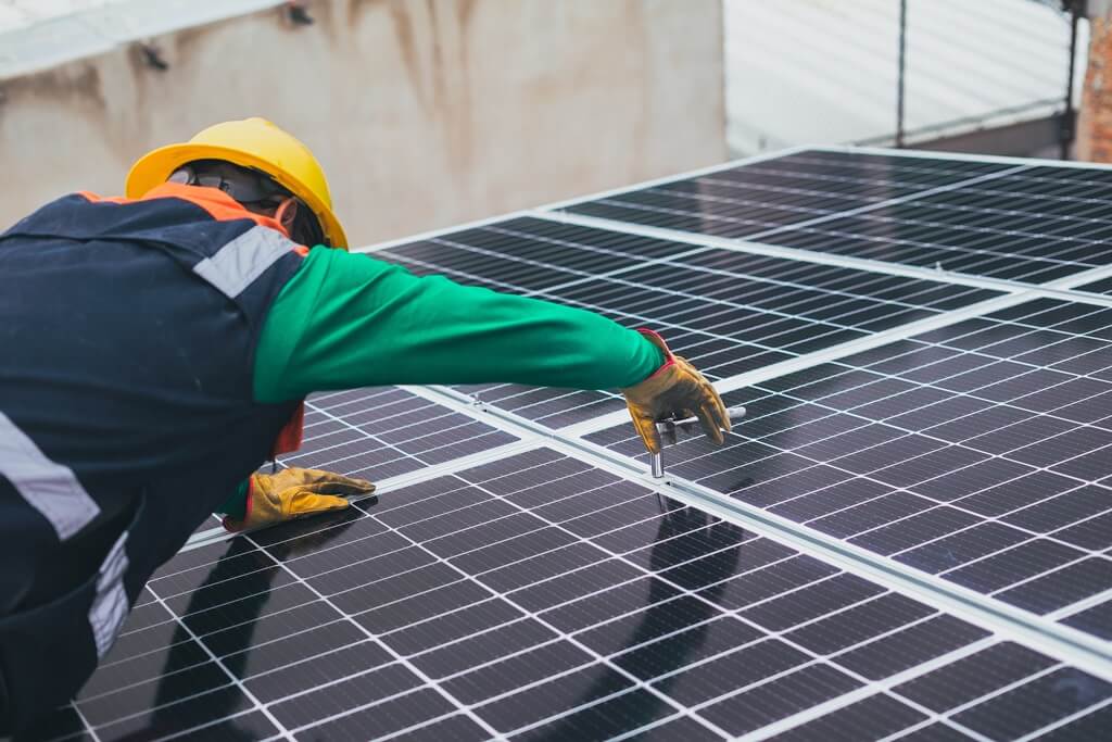
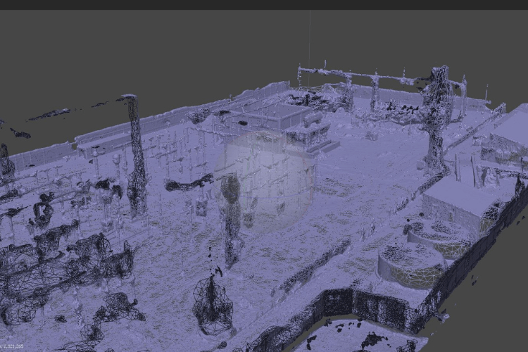
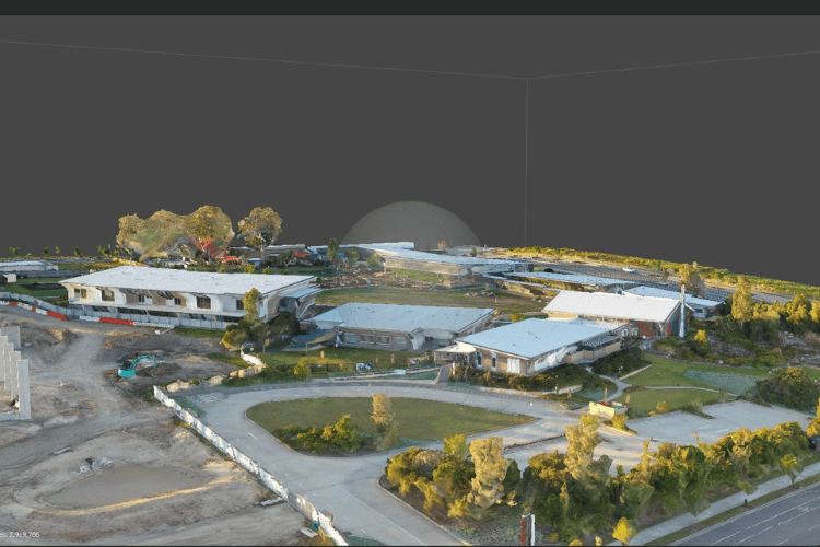
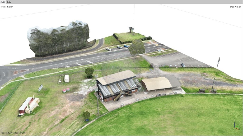
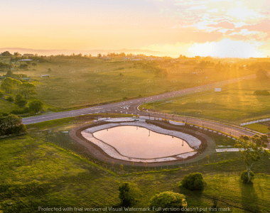
Magazine Quality at Affordable Budgets

We are a team of experienced drone operators with the necessary equipment and permits to complete your project. Our rates are competitive and market-leading, and we can match the prices of other commercial drone operators.

Protected up to $20M for public liability

Safety is paramount in all aspects of our operations. We are fully licensed and insured by CASA, which ensures that we have the necessary expertise and resources to operate safely and efficiently.

Advanced camera and UAV technology

Our commitment to providing high-quality service is made possible by our investment in advanced drone systems and camera equipment.

Services We Offer for Agriculture Industry

Upload Enterprise is a leading provider of drone services for the agriculture industry, offering a variety of services to help farmers improve their operations and increase their bottom line

Solar farm panel inspections

Capture the beauty of your farm and its surroundings with our expert farm and landscape photography service. Our skilled photographers have a deep understanding of agricultural environments, ensuring that every shot showcases the natural beauty and unique features of your farm. From sweeping panoramic views to close-up shots of crops and livestock, we’ll provide you with stunning images that highlight the essence of your agricultural enterprise.

solar panel inspection
Drone Survey

Solar farm aerial survey

Bring out the individual personalities and character of your livestock with our specialized livestock portrait photography service. Our experienced photographers have a knack for capturing the unique traits and expressions of each animal, creating images that resonate with viewers. Whether it’s a proud stallion, a contented flock of sheep, or a curious herd of cows, we’ll ensure each animal is represented in its best light.

Farm & agriculture aerial survey

Gain a fresh perspective of your farm with our cutting-edge aerial photography and videography service. Using state-of-the-art drones, we’ll capture stunning aerial views that showcase the scale and layout of your agricultural operation. From high-altitude shots of sprawling fields to dynamic video footage of tractors in action, our aerial service adds an exciting dimension to your farm’s visual representation.

Drone mapping of school in sydney
Drone Survey

Farm 3D mapping and modelling

A drone survey is the use of drones or unmanned aerial vehicles (UAVs) equipped with RGB cameras, multispectral cameras,  payloads to collect data. And then this data is transmitted to special equipment on the ground near the UAV operator. The end result of drone land surveying is a finished map of detail at a given scale, presented in digital format.

Surveying drones can fly at much lower altitudes than traditional techniques like manned aircraft or satellites, providing high-resolution, high-precision images faster and cheaper, and independent of weather conditions such as cloud cover.

Topographic Contour and Elevation Mapping

Experience the passage of time on your farm like never before with our captivating time-lapse photography and videography service. We’ll create mesmerizing sequences that showcase the growth of crops, the movement of livestock, and the changing scenery over extended periods. These visual narratives provide a unique perspective on the dynamic nature of agriculture.

Drone mapping of school in sydney
Drone Survey

Product Photography for Agricultural Businesses

Elevate your agricultural products with our specialized product photography service. Whether you’re selling produce, artisanal goods, or agricultural equipment, our photographers will expertly showcase your offerings in a way that highlights their quality and appeal. From close-ups of fresh produce to detailed shots of machinery, we’ll help you make a powerful visual impact in the market.

Projects We Have Worked On

Image Gallery

Our Videos

Trusted By

Our Clients

Why You Should be Using Upload Enterprise

Upload Media Services is a leading provider of commercial aerial mapping, drone surveys and aerial photography. We are CASA certified and fully insured, and we offer a wide range of services, including Lidar mapping, thermal mapping, multispectral mapping, and orthophotography.

  • Certified and licensed by CASA
  • Public Liability Insurance of $12 Million
  • Professional Liability Insurance of $6 Million
  • Safety assessments for jobs
  • Mine/Construction Spec Vehicles and Full PPE
  • Drone fleet of the future
  • GNSS ground control with PPK precision

Drop your Inquiry Here​