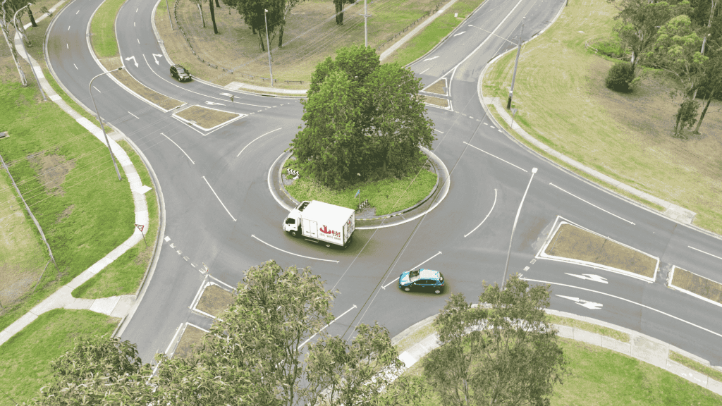
The Ingleburn Roundabout, located in Eaglevale, New South Wales, serves as a critical junction for local and regional traffic. Given its importance in managing traffic flow and safety, a comprehensive traffic survey was necessary to assess current conditions and identify potential improvements. Traditional methods of traffic surveying often involve manual counting and time-consuming data collection processes. To enhance efficiency and accuracy, drone technology was employed for this survey.
Objectives
The primary objectives of the drone survey at the Ingleburn Roundabout included:
- Traffic Flow Analysis: To gather data on vehicle counts, speeds, and movement patterns.
- Queue Monitoring: To identify congestion points and delays during peak hours.
- Safety Assessment: To evaluate the effectiveness of current traffic control measures.
Methodology
Drone Technology Utilized: The survey utilized unmanned aerial vehicles (UAVs) equipped with high-definition cameras capable of capturing detailed aerial footage. The drones were flown at altitudes sufficient to cover the entire roundabout and surrounding intersections.
- Preparation: Prior to the survey, a flight plan was developed to ensure comprehensive coverage of the area. This included identifying key observation points around the roundabout.
- Data Collection: The drone operated during peak traffic hours to capture real-time data. A total of 3 flights were conducted over a span of several hours, collecting thousands of images and videos.
- Data Processing: The captured footage was analyzed using advanced software tools to extract meaningful traffic data. This included vehicle counts, speed analysis, and movement patterns across various lanes.
Visual Solutions
The drone survey provided an extensive visual dataset that allowed for a thorough examination of traffic conditions:
- High-Resolution Imagery: Over 1,500 high-quality images were captured, offering clear views of vehicle movements and queue lengths.
- Aerial Video Footage: Continuous video recording enabled real-time monitoring of traffic flow and behavior at the roundabout.
Results
The findings from the drone survey yielded significant insights into the operation of the Ingleburn Roundabout:
- Traffic Volume: The analysis revealed peak traffic volumes during specific times of day, identifying key congestion periods.
- Vehicle Speeds: Average speeds were calculated at various entry and exit points, highlighting areas where speed limits may need enforcement.
- Queue Lengths: Data indicated that certain lanes experienced longer queues than others, suggesting a need for traffic signal adjustments or additional signage.
Benefits of Drone Surveys
The use of drone technology for this traffic survey offered several advantages over traditional methods:
- Cost Efficiency: Reduced labor costs associated with manual counting and data collection.
- Safety: Minimization of risks associated with on-ground surveying in high-traffic areas.
- Speed of Data Collection: Rapid acquisition of extensive data sets without disrupting traffic flow.
Conclusion
The drone survey conducted at the Ingleburn Roundabout provided valuable insights into traffic dynamics in Eaglevale, NSW. By leveraging advanced UAV technology, planners and traffic engineers can make informed decisions to enhance traffic management strategies, improve safety measures, and ultimately reduce congestion in this vital area. The success of this project underscores the potential for drone surveys to revolutionize traffic monitoring practices across urban environments.

3awniw