Today high accuracy of aerial survey has become commonplace. It is easy to get lost in the different acronyms and their concepts. When you have thought of using GCP on your sites using RTK drone surveys that capture both RTK and PPK data. There is no matter where you have to start. You have to take a step back and look at how these technologies differ and when to appropriately use them.
What is RTK?
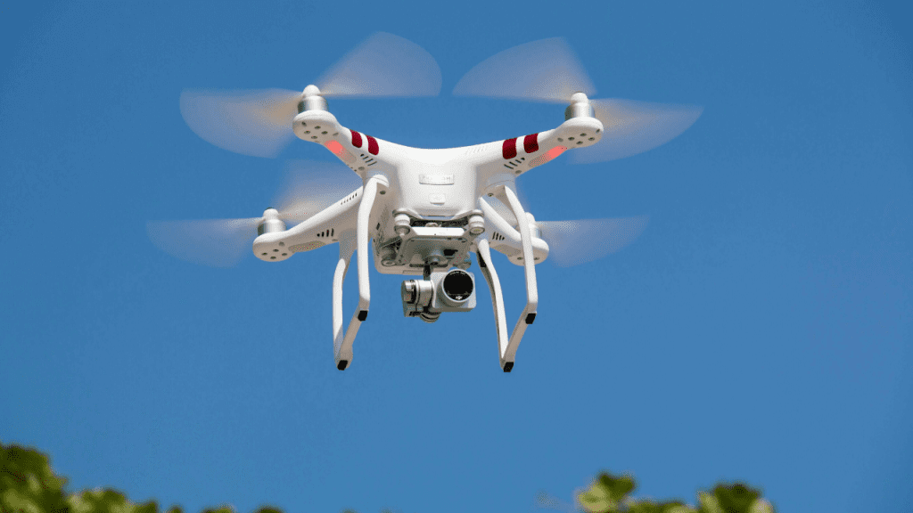
RTK stands for Real-Time Kinematic. This is a GPS correction technique that provides real-time correction data while the drone is capturing imagery. The drones like DJI Phantom 4 RTK, Mavic 3 Enterprise RTK, and RTK drones. They can be possible for capture desired accuracy data without used any GCP in Aerial survey.
It can improve the precision of positional data from satellites based on positioning systems. RTK trusts a single reference station to deliver correction data for geotags during flight. It hasn’t meant only using GPS data from the drone. Drones can be positional information from nearby reference stations for accuracy in pinpointing the location. They give the accurate position of the drone but do not give any specific information about any point on the ground. We suggest using GCP in conjunction with an RTK drone to get the best map accuracy.
The Phantom 4 RTK is one of the drones that can capture high-accuracy data without the need to place any GCP. For further information on our testing of the Phantom 4 RTK, check the P4RTK Whitepaper is the lookout for our newer, Mavic 3 Enterprise RTK whitepaper.
The benefits of using RTK drones are pretty obvious. It allows for survey at a fraction of the time, increased mapped survey accuracy. The drone operator has allowed for capturing more accurate data frequently.
The draw bake of RTK drones is as given:
Aerial survey RTK technology is still a relatively new concept. When you operate a drone there is required some base station or a subscription to a network. There is a requirement for clear views for capturing accurate data.
RTK drone that can work on open areas with minimum trees, buildings, and other obstacles to maintain a strong connection to the base station. When drone can lose their connection, they can’t obtain accurate data.
What is PPK?
PPK which is stands for Post Processed Kinematic. PPK is another GPS correction technology similar to RTK that works to collect pointed-located data. There is one difference location data is updated after the drone has captured the image, thus being “post-processed.”
The main advantage of using these forms of capturing is to increase PPK vs RTK accuracy. You can also use Phantom 4 RTK or Mavic 3 Enterprise RTK for capturing PPK data as well. You have to set up an easy base station for more flexibility to capture data.
The benefits of using PPK drones are that can fly in a crowded environment without a visual line of sight such as the city center. It can capture high-precision data and conduct longer flights over varied terrain.
Even without losing connection resulting in inaccurate data. We can suggest using some GCP as PPK data to increase map accuracy. You must be sure that the checkpoint as well to validates overall accuracy once the map is processed.
What are GCPs?
GCP that can stand for Ground Control Point. They can allow the surveyors to collect data by defining known points on the surface of the earth and using those points to geo-reference aerial imagery. The surveyors can walk around the job site. A GPS receiver for capturing hundreds or thousands of points provides an accurate grid.
When surveyors convert this grid into a surface, it can coordinate estimations of stockpile volumes. During earthwork, mainly track the progress during the construction.
Today many drone operators can still use GCP for accurate position. The drone deploys maps to know their reference points. It can even use these reference points as checkpoints for measuring map accuracy.
The above description knows about what is RTK, PPK, AND GCP for Aerial surveys.
Here is some difference between GCP VS PPK VS RTK
GCP vs RTK vs PPK
This is up to the user to determine the best option for your survey. If you have a small area, using GCP can help you capture highly accurate data in the shortest time possible without using the RTK AND PPK Platform.
When you are mapping a large area, wide open areas some are changing to consider RTK drones vs GCP imagery. If you are flying a close quarter in the crowded market for conducting long-duration flights. You must consider strong signal strength for capturing PPK imagery. When you are looking for the best absolute accuracy that combine PPk image with GCP on your site.