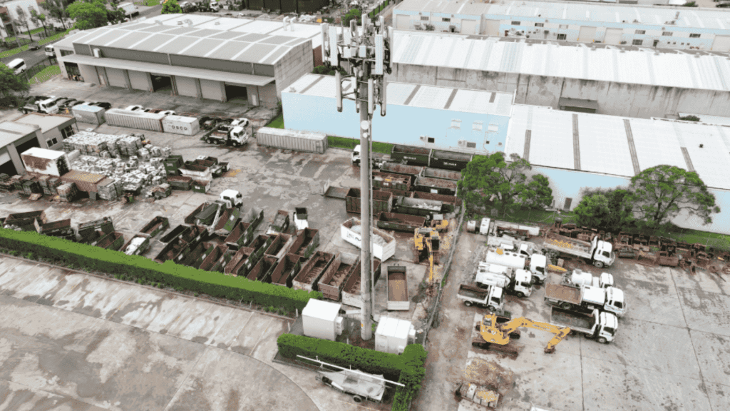
Ingleburn, a suburb in southwestern Sydney, NSW, is home to several critical telecommunications infrastructure sites, including telephone towers. These structures are essential for maintaining reliable mobile and internet services across the region. However, assessing and maintaining these towers can be challenging due to their height and remote locations. This case study explores how drone technology, specifically drone photos and 3D drone mapping tools, can enhance the assessment and maintenance of telephone towers in Ingleburn.
Background
Telephone towers in Ingleburn serve a large population and are crucial for emergency services, businesses, and residents. Regular inspections are necessary to ensure optimal performance and safety. Traditional methods involve using cranes or personnel climbing the towers, which are time-consuming, costly and pose significant safety risks.
Objectives
- Safety Enhancement: Reduce the risk of accidents associated with manual inspections.
- Cost Efficiency: Minimize costs related to equipment rental and personnel deployment.
- Data Accuracy: Obtain precise and detailed data on the tower’s condition using high-resolution images and 3D mapping.
Methodology
- Drone Deployment: A two-person crew was deployed to conduct the assessment using a high-resolution drone equipped with a 4K camera and GPS navigation.
- Data Collection: Over 500 high-quality images were captured, covering all sides of the tower and its surroundings.
- 3D Mapping: Advanced software was used to create a detailed 3D model of the tower, allowing for precise measurements and visual inspections.
- Data Analysis: The collected data was analyzed to identify any structural issues, damage, or areas requiring maintenance.
Visual Solutions
- High-Resolution Imagery: Drone photos provided detailed views of the tower’s structure, including antennas, cables, and support beams.
- 3D Modeling: The 3D model enabled a comprehensive assessment of the tower’s condition, facilitating the identification of potential issues that might not be visible through traditional inspection methods.
- Risk Reduction: No personnel were required to climb the tower, significantly reducing safety risks.
- Cost Savings: The use of drones eliminated the need for expensive machinery rental and reduced labor costs.
Benefits
- Enhanced Safety: Minimized risk to personnel by avoiding the need for physical climbs.
- Increased Efficiency: Rapid data collection and analysis reduced the overall inspection time.
- Improved Accuracy: High-resolution images and 3D models provided detailed insights into the tower’s condition.
- Cost-Effectiveness: Reduced costs associated with equipment rental and personnel deployment.
Conclusion
The use of drone photos and 3D drone mapping tools for telephone tower assessment in Ingleburn, NSW, offers a safe, efficient, and cost-effective solution. This technology enhances the accuracy of inspections, reduces safety risks, and streamlines maintenance processes. As telecommunications infrastructure continues to evolve, integrating drone technology will become increasingly important for ensuring reliable and efficient service delivery.

y87jkk
igbxes
3tis00
wfd5fp
mc9sze
hrf5bn
uc1esc
g0wds6
wxcp23
fh9gad
heff1y
rgq2vg
htst8u
cajcx3
zu7jyg