The introduction of drone technology in the recent past has transformed the world of aerial mapping. If we have a look at the traditional mapping method we will notice that it is a time-consuming process, expensive and there are quite a few limitations. However, the introduction of drones having modern photogrammetry capabilities has revolutionized the way of capturing aerial photography. The fusion of this technology has opened unprecedented potential in many fields. We now see the use of drone photogrammetry in various fields like urban planning, agriculture, monitoring environmental factors and management of disasters.
Today we will explore the role of such photogrammetry in aerial mapping. We will discuss its applications, advantages, challenges and future prospects. As we understand its capabilities, and challenges we can understand its importance in reshaping the way we perceive and interact with our surroundings.

What do we mean by drone photogrammetry?
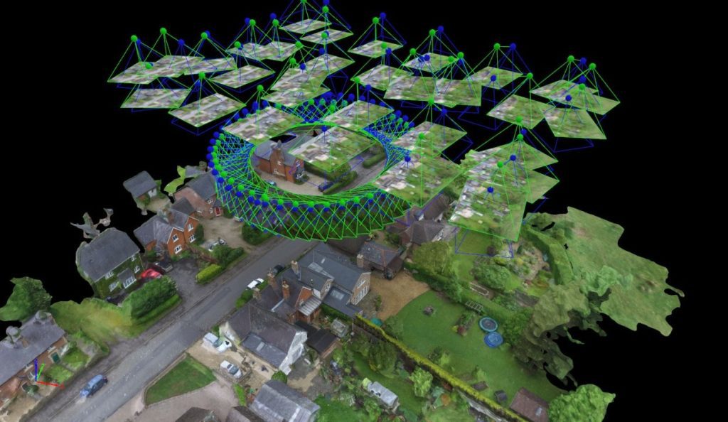
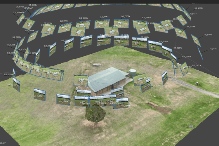
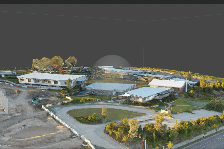
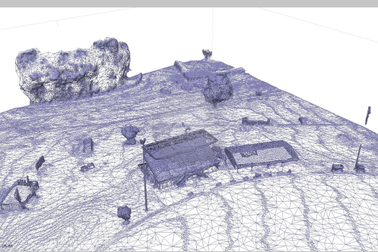
This is a technique where we use drones having modern photogrammetry capabilities to capture aerial photographs of any landscape, or object from various angles. It also means the use of specialized software to stitch the overlapping drone photography to develop accurately detailed maps, models or 3D images. The principles of triangulation and perspective guide the process of determining the spatial relationship between the objects in the picture. This helps to generate detailed geometric data.
Applications of Drone Photogrammetry
As this is a versatile process, it has applications across various industrial fields. Let us have a look at some of those.
Urban Planning and Development: There is use of this nature of photography by urban planners. It helps them to assess the use of land, infrastructure, and other environmental factors. Such assessment helps them to design and manage cities and communities.
Agriculture: When we think about precision agriculture we cannot avoid the use of drones fitted with multispectral cameras to capture accurate pictures of crops. Such data allows farmers to monitor plant health, and locate attacks of pests and diseases. It also helps to optimize the allocation of resources.
Environmental Monitoring: It is possible for researchers and conservationists to gather useful data pertaining to deforestation and wildlife habitats and assess the impact of natural disasters using drone photogrammetry. Such data helps them to analyse and manage environmental factors.
Construction and Infrastructure: We can notice the use of this aerial photography methodology by construction companies for site surveys, monitoring progress and planning of projects. This helps in increasing efficiency and to reduce costs.
Archaeology and Cultural Heritage: This nature of aerial photography is widely used by archaeologists for surveying archaeological sites. They also use this to map features of terrains and develop a digital reconstruction of ancient sites to enable research and preservation efforts.
How beneficial is drone photogrammetry
There are various compelling advantages associated with drone photography. It is much more advantageous when compared with traditional mapping methods. Let us know about a few of the associated advantages.
Cost-Effectiveness: It is more affordable to deploy drones having sophisticated cameras than manned aircraft or satellites. Such affordability has made it possible for various organizations to use this technology for aerial photography.
Rapid Data Acquisition: It is possible for a drone to cover large areas and capture high-resolution pictures in a very short period. This swift action has made it the ideal tool to have real-time monitoring and response rapidly during emergencies.
High Precision and Detail: It is possible to capture precise images from different perspectives using drones filled with sophisticated cameras. Using drone photogrammetry it is possible to develop accurate maps and models showing intricate details.
Flexibility and Accessibility: Drones can navigate terrain that is difficult or dangerous for ground-based surveyors, providing access to remote or hazardous locations for data collection.
Flexibility and Accessibility: It is possible for a drone to cover terrains that are not easily accessible manually. So, surveyors can now make detailed maps of difficult terrains without any risks.
Challenges and Considerations
Though there are various associated advantages, there are a few challenges and considerations involved with this technology.
Regulatory Compliance: There may be airspace regulations or no-fly zones and it is not possible to use drones in such terrains to capture pictures. One needs to adhere to these regulatory compliances.
Data Processing and Analysis: Drones capture multiple overlapping pictures. There needs to be highly sophisticated software to analyse these pictures before the development of maps or models.
Weather and Environmental Factors: If there is high wind or rain it is not possible to fly a drone to capture pictures. In such conditions, it is not possible to capture quality data. So, there needs to be careful planning and management when there is use of drones to capture pictures.
Data Accuracy and Validation: There needs to be ground control points and validation against ground-truth data to generate high-precision pictures.
Future Directions
There are exciting possibilities for innovation and advancement in drone photogrammetry.
Integration with Emerging Technologies: It is possible to integrate drones with upcoming technologies like AI, LiDAR and augmented reality to increase the capabilities and applications of aerial mapping.
Autonomous Operation: Ongoing development of autonomous flight systems and intelligent navigation algorithms will be enabling drones to operate with increased autonomy and efficiency. It will reduce the need for manual piloting.
Enhanced Data Analysis and Visualization: There is regular development of data analytics and visualization techniques. This will allow more sophisticated analysis of aerial pictures and unlock more in-depth insight related to spatial patterns and trends.
We now know quite a bit about drone photogrammetry. However, if the challenges and considerations are holding you back from using this innovative technique for aerial photography then it is wise to contact Upload Enterprise at +61 401 957 996. They will make it possible to have the required drone photography according to your requirements. They make it possible to have affordable and professional aerial photography as they have CASA-licensed and certified drone operators. Their goal is to understand your unique needs and provide customized solutions that solve real-world challenges with care, skill and technological innovation. By leveraging the strengths of their personnel and equipment they deliver highly-accurate topological maps and 3D terrain models with resolution and precision down to the centimeter.